Did you know Ground Penetrating Radar (GPR) can unveil subsurface structures up to 100 feet deep? This technology surpasses traditional survey methods, offering insights into what lies beneath. Radar pulses create detailed images of the underground, empowering professionals across various fields. It’s a game-changer for uncovering archaeological treasures and locating utility lines, making it a crucial tool in modern research and construction.
Key Takeaways
- Ground Penetrating Radar offers a unique, non-invasive method for subsurface imaging.
- GPR technology is effective for applications ranging from archaeology to utility location.
- This method permits deep insights, sometimes reaching depths of 100 feet or more.
- Understanding GPR enhances the accuracy of construction and environmental assessments.
- Ground Penetrating Radar aids in decision-making by providing real-time, actionable data.
- Though it has limitations, the benefits of GPR are significant across multiple industries.
What is Ground Penetrating Radar?
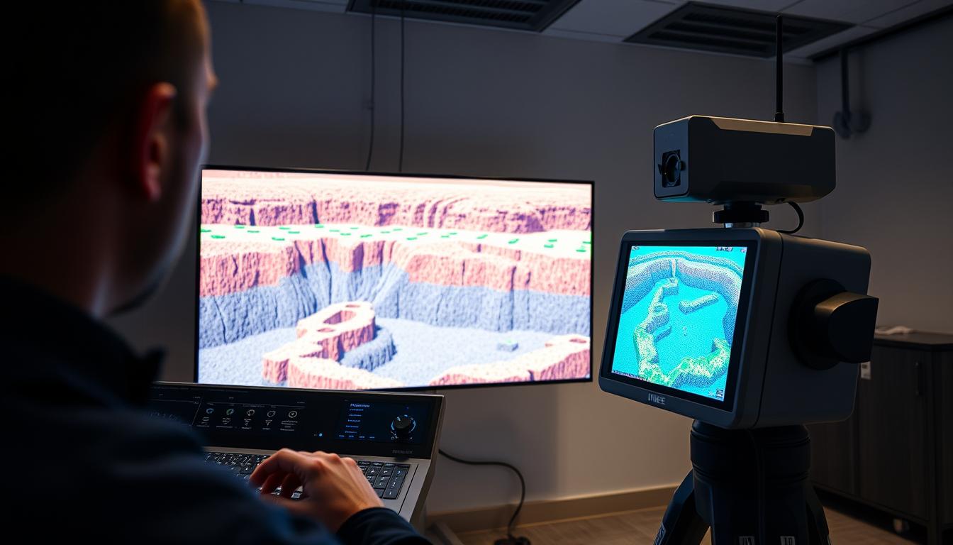
Ground penetrating radar (GPR) is a sophisticated geophysical technique for subsurface exploration. It employs electromagnetic radiation in the microwave band to uncover objects or layers beneath the earth’s surface. This method is considered a non-destructive testing approach, enabling operators to visualize underground conditions without excavation or disruption.
Definition and Basics
The core concept of ground penetrating radar involves sending a radar pulse into the soil. When these radar waves encounter different materials or interfaces, some waves reflect back to the surface. A receiver captures these returning signals, creating a detailed profile that aids in underground scanning.
How It Works
To understand GPR, one must grasp the physics behind radar wave propagation. The system consists of a transmitter and receiver, typically integrated with antennas, which determine the frequency used for the survey. Lower frequencies can penetrate deeper, ideal for broad assessments, while higher frequencies provide more detail for shallower scans. The resulting data assists in various fields, including geophysical surveying and archaeology.
Key Components
The major elements that make up a GPR system are:
- Transmitter: This component generates the electromagnetic signals.
- Receiver: It captures the reflected radar waves.
- Antennas: These devices are crucial for determining the survey’s frequency and depth of penetration.
These components work together to create insightful images of subsurface structures, making ground penetrating radar a vital tool in numerous applications. For further detailed insights, you can visit this guide on ground penetrating radar.
History of Ground Penetrating Radar
The evolution of ground penetrating radar (GPR) is a captivating narrative of technological progress. Its inception dates back to the 1920s, driven by the ambition to uncover what lies beneath. Yet, it wasn’t until the 1970s that GPR technology began to see practical use. Initially, its applications were primarily in the military sphere, aimed at detecting hidden explosives and munitions.
Early Development
In its nascent stages, GPR’s primary objective was to serve military needs. The early history of this technology highlighted its capability to identify subsurface anomalies. This caught the interest of both researchers and military personnel, marking a significant beginning.
Significant Milestones
The 1980s were pivotal for GPR technology, as archaeologists discovered its non-invasive potential for historical site exploration. This breakthrough enabled the detection of buried artifacts without the need for extensive excavation. Such advancements in geophysical innovations revolutionized archaeology, leading to more precise research methods.
Modern Advancements
Ground penetrating radar has seen substantial modern advancements. Improvements in signal processing and imaging have significantly enhanced its capabilities. These developments have broadened its applications to include civil engineering, environmental studies, and mining. This expansion underscores the technology’s growing relevance across diverse fields.
Applications of Ground Penetrating Radar
Ground penetrating radar (GPR) exhibits a wide array of applications across various disciplines, showcasing its versatility and effectiveness. It is employed by professionals for tasks such as archaeological surveys, geology mapping, utility locating, and forensic science. Each field benefits from its non-invasive nature, providing vital insights without causing damage.
Archaeology
In archaeology, GPR applications are particularly noteworthy. They enable the detection of buried structures and artifacts without the necessity of invasive excavation. This approach allows archaeologists to delve into historical sites more effectively, causing minimal disruption to the surrounding environment.
Geology
GPR is indispensable in geology, aiding researchers in mapping geological formations and identifying groundwater sources. By employing GPR, geologists can dissect subsurface layers, thereby gaining a profound understanding of the Earth’s composition.
Utility Location
Utility locating is another crucial domain where GPR proves invaluable. It facilitates the identification of underground pipes and cables. This capability significantly reduces the risk of accidental damage during construction, safeguarding infrastructure and personnel alike.
Forensic Investigations
In forensic science, GPR applications are indispensable. Investigators can pinpoint buried evidence, such as remains or weapons, at crime scenes. This non-invasive method enhances forensic investigation efficacy, enabling thorough examinations while maintaining the site’s integrity.
Benefits of Using Ground Penetrating Radar
Ground penetrating radar stands out for its non-invasive testing capabilities, making it perfect for numerous applications. It allows for deep exploration without touching the surface, thus reducing environmental harm. Moreover, it offers high-resolution imaging, essential for precise assessments of underground structures. This combination results in a cost-effective method for subsurface imaging, eliminating the need for more invasive and pricey techniques.
Non-Invasive Exploration
Professionals can collect vital data without harming the site, thanks to ground penetrating radar. This is crucial in urban settings or sensitive areas where damage could be severe. The non-invasive nature of this technology ensures that utilities and archaeological sites can be mapped without disruption.
High Resolution Imaging
One of the most significant benefits of ground penetrating radar is its ability to produce high-resolution images of subsurface structures. These detailed images improve our understanding of what lies beneath and aid in making better decisions. In construction, accurate imaging is key, helping engineers to grasp site conditions before starting their work.
Cost-Effectiveness
Ground penetrating radar is a cost-effective option for subsurface imaging compared to traditional methods. It reduces excavation needs and labor costs, leading to substantial savings. This efficient technique saves both money and time, allowing for faster project completion and enhanced safety for everyone involved.
Limitations of Ground Penetrating Radar
Ground penetrating radar (GPR) brings unique benefits to subsurface exploration, yet it faces several limitations. These constraints pose specific challenges in achieving clear subsurface imaging across diverse environments.
Depth Limitations
GPR’s penetration depth is a notable constraint. It is generally effective up to about 10 meters. Beyond this, detecting objects becomes increasingly challenging. Moisture-rich soils, like clay, can further complicate depth accuracy by dissipating radar signals.
Material Challenges
Distinguishing between materials with similar electromagnetic properties is a significant challenge for GPR. This can lead to misinterpretation of data, complicating precise evaluations. Such material challenges hinder the accuracy needed for various assessments.
Environmental Factors
Environmental conditions also impact GPR’s efficiency. Groundwater saturation or significant temperature changes can affect radar system performance, resulting in inconsistent results. Overcoming these environmental factors is essential for enhancing data reliability in GPR applications, providing valuable insights into subsurface structures.
Recognizing these limitations is crucial for optimizing GPR technology. For more detailed insights, exploring guidelines on effective subsurface surveys here may be beneficial.
Comparing Ground Penetrating Radar to Other Methods

Ground penetrating radar (GPR) stands out as a crucial tool in exploring subsurface areas, showcasing distinct advantages over other geophysical methods. The comparison between GPR and electromagnetic methods reveals their differing imaging capabilities, influencing the selection of techniques for specific tasks. This analysis underscores the strengths and weaknesses of GPR alongside other survey techniques.
Electromagnetic Methods
Electromagnetic methods employ lower frequencies to examine subsurface materials. These approaches can identify electrical resistivity differences but lack the high-resolution imaging of GPR. In the context of ground penetrating radar vs electromagnetic methods, GPR’s ability to produce detailed images of underground structures is unmatched.
Seismic Surveys
Seismic surveys probe deeper into the earth, gathering data on subsurface geological formations. Though effective for broad geological insights, they require complex setups and can be time-consuming. GPR, on the other hand, offers rapid data collection and immediate insights into shallow subsurface features, making it a preferred choice in many applications.
Traditional Surveying Techniques
Traditional surveying techniques provide essential surface measurements but fail to visualize underground conditions effectively. GPR’s capability to unveil subtleties beneath the surface distinguishes it as a comprehensive tool for subsurface analysis. This ability significantly enhances project planning across various sectors, including construction and archaeology.
Choosing the Right Ground Penetrating Radar System
Optimal results in various applications depend on the selection of the appropriate GPR system. Several factors influence this choice, including the depth range, resolution, and specific application types. Understanding these factors is crucial for survey effectiveness.
Factors to Consider
Before making a decision, consider the following:
- Depth Range: Determining how deep the survey must reach is essential for selecting the right system.
- Resolution: Higher resolution systems provide more detailed images, which can be vital for certain applications.
- Application: Different projects require tailored solutions, making it important to choose a system designed for specific uses.
Different Types of Systems
Various types of ground penetrating radar are available in the market. Some of the most common include:
- Cart-based Systems: These are ideal for large areas, offering stability and precision.
- Handheld Systems: Compact and versatile, these are suitable for smaller, more intricate surveys.
- Vehicle-mounted Systems: These provide efficient coverage of extensive landscapes, useful for infrastructure surveying.
Manufacturers
Several reputable GPR manufacturers offer a range of systems to meet diverse needs. Notable companies include:
- Geophysical Survey Systems, Inc. (GSSI): Known for innovative solutions and robust systems.
- IDS GeoRadar: Specializes in advanced GPR technology with various configurations.
- Mala Geoscience: Offers tailored systems suitable for many applications and environments.
Tips for Effective Ground Penetrating Radar Surveys
Conducting effective GPR surveys necessitates meticulous planning and execution. A critical step is a comprehensive site assessment to uncover potential issues that could compromise survey accuracy. These GPR survey tips are instrumental in improving the quality of the data obtained.
Proper Site Assessment
A thorough site assessment is the cornerstone of a successful GPR survey. It involves evaluating soil composition, potential underground structure interference, and environmental conditions. Recognizing these factors early optimizes equipment settings, resulting in more dependable outcomes.
Understanding the Data
Accurate data interpretation is paramount after data collection. It is essential to familiarize oneself with signal responses for various materials. This knowledge enables precise differentiation between subsurface features. Resources like understanding GPR data are invaluable for making informed decisions during interpretation.
Common Mistakes to Avoid
Several errors can undermine the effectiveness of a GPR survey. Inadequate equipment calibration can result in misleading data. Misinterpretation of data outputs complicates analysis further. Additionally, neglecting environmental impacts can distort interpretations. By avoiding these common pitfalls, users can significantly improve the reliability and precision of their surveys.
Ground Penetrating Radar in Environmental Studies

Ground penetrating radar (GPR) is a pivotal tool in environmental studies, offering diverse applications for understanding subsurface conditions. Its capability to provide real-time, high-resolution imagery makes it indispensable for various environmental assessments. This technology is crucial for comprehending and managing complex subsurface environments.
Assessing Contaminated Sites
GPR is essential for assessing contaminated sites, enabling experts to visualize the extent and distribution of pollutants beneath the surface. It aids in pinpointing areas needing remediation. GPR delivers detailed subsurface images, crucial for determining contamination nature and levels. This information is vital for crafting effective cleanup strategies.
Mapping Underground Infrastructure
GPR’s application in mapping underground infrastructure is another critical aspect of environmental studies. It is vital for environmental engineers, providing essential information on existing utility locations and conditions. This knowledge minimizes the risk of accidental damage during excavation and construction, ensuring safer and more efficient operations.
Monitoring Groundwater
Groundwater monitoring is another area where GPR demonstrates its effectiveness. It aids in studying subsurface water flow and tracking groundwater levels over time. Such insights are crucial for ensuring environmental regulation compliance and making informed water resource management decisions.
Future Trends in Ground Penetrating Radar Technology
The future of GPR technology is brimming with potential. Advancements in radar processing are poised to transform data interpretation. Sophisticated software will enhance imaging, allowing for clearer views of subsurface structures. This evolution promises both efficiency and accuracy, opening new avenues for various industries.
Advancements in Processing Software
Modern processing software is advancing beyond traditional methods. Machine learning and artificial intelligence are leading the charge, enhancing GPR data interpretation capabilities. These innovations will expedite analysis and boost the accuracy of subsurface imaging. As a result, users across multiple sectors will have access to superior data, crucial for decision-making and planning.
Integration with Other Technologies
The integration of GPR with other technologies is a key trend. Combining GPR with drone mapping and GIS offers unparalleled analytical capabilities. This integration will enable professionals to gather comprehensive data, enriching their assessment processes. The synergy of these technologies will enhance field applications and improve project outcomes.
Emerging Markets
The demand for GPR is expected to surge in emerging markets, particularly in renewable energy and urban development. As the benefits of subsurface exploration become more apparent, industries will increasingly adopt GPR for various applications. This trend underscores a shift towards innovative solutions, addressing contemporary challenges and ensuring future sustainability.
Training and Certification for Ground Penetrating Radar
The importance of GPR training and certification is paramount for those engaged in subsurface investigations. A well-structured training program imparts the necessary skills to operate GPR systems effectively. It also teaches users how to interpret data accurately and maintain safety standards. As technology advances, the necessity for formal education in this area grows exponentially.
Why Training is Important
The significance of GPR training is undeniable. Without proper education, users may find it challenging to derive valuable insights from the data collected. A combination of practical experience and theoretical knowledge is crucial. It helps in overcoming the hurdles posed by various site conditions and ensures compliance with established protocols. Trained professionals significantly enhance project outcomes.
Available Courses and Programs
Several organizations provide GPR training and certification programs for both novices and seasoned operators. These available courses typically combine classroom instruction with hands-on field training. Institutions like the Geophysical Society and private training firms offer comprehensive resources. These resources are designed to prepare individuals for the challenges they will encounter in the field. By exploring these options, prospective operators can find programs that align with their needs and objectives, thereby improving their GPR operation and analysis skills.
Case Studies Using Ground Penetrating Radar
Ground penetrating radar (GPR) has demonstrated remarkable efficacy across diverse applications. Its utility in historical research, infrastructure safety, and emergency scenarios is particularly noteworthy. Through detailed case studies, the versatility and potential of GPR in these fields become clear.
Historic Site Excavations
In the realm of historic site excavations, GPR emerges as a crucial tool. It enables archaeologists to map out buried structures without disrupting the soil. This non-invasive method provides high-resolution images of subsurface features, thus safeguarding the integrity of sensitive archaeological sites. Consequently, GPR is instrumental in uncovering hidden artifacts and architectural remnants.
Infrastructure Monitoring Projects
GPR technology significantly enhances infrastructure monitoring. It is instrumental in evaluating the condition of roadways, bridges, and tunnels. GPR’s ability to identify underlying issues facilitates proactive maintenance and repair planning. This approach not only boosts safety compliance but also optimizes maintenance efforts.
Disaster Response Applications
In emergency contexts, GPR emerges as a critical asset for disaster response. Its capacity to locate survivors trapped beneath debris during earthquakes or floods underscores its rapid response capabilities. Additionally, GPR aids in identifying hazards, enabling rescuers to devise efficient response strategies.
Conclusion: The Future of Ground Penetrating Radar
The benefits of GPR are becoming more apparent, highlighting its crucial role in subsurface investigations. Ground penetrating radar offers non-invasive exploration, providing high-resolution imaging that is both effective and cost-efficient. These features not only save time and resources but also yield detailed insights into hidden structures and materials beneath the surface.
Looking ahead, the future of ground penetrating radar will heavily rely on the importance of innovation. Advancements in processing software and the integration of GPR with emerging technologies are poised to enhance its capabilities even further. This evolution will make GPR more accessible and applicable across various sectors, including construction, environmental studies, and archaeological research.
In embracing the potential applications of GPR, we pave the way for broader acceptance and effectiveness in solving complex subsurface challenges. To explore ways to enhance your business success, consider implementing innovative strategies that utilize the advancements in ground penetrating radar technology, ensuring it remains a critical tool in our quest to understand the unseen world beneath our feet.